


I cost nothing to run so donate to https://www.broadcastingscotland.scot/donate/
The bilingual blog about all things British
Love, theatre and ideas
British Wildlife & Photography
Why Scotland should be an independent country
Thoughts about Scotland & the world, from a new Scot
Bipartisan dialogue for the politically engaged
Impartial Everytime Always
Exploring Rhymes, Reasons, and Nuances of Our World
Mark Doran's Music Blog
Songwriter / Guitarist
This site supports Scottish Independence
A comic about history and stuff by FT
The embittered mumblings of a serial malcontent.
an irreverent look at UK politics
Exploring the Depths of Curiosity
Nature + Health
http://netbij.com
Movies, politics, comedy and more...

I liked the mouse who prefers chocolate muffins to bread scraps.
I had to check out the Vietnamese bridge for authenticity. Looked too crazy not to be Photoshopped.
Nice mountains! Mount Rainier is a picture post card favorite. Also one of the most dangerous based on volcanic activity and its threat to the metropolitan Seattle area. The Alaskan mountains are big…..like the state. I saw this map the other day. Scaled by geographic area. Not an artifact of map projection.
Alaska has one-fifth of the total land area of the lower 48 states, and is larger than the combined area of 22 of the smallest states. With a population smaller than San Francisco and only a little larger than Glasgow.
LikeLiked by 1 person
Danny, you’d better get Alaska out of there and put it back where it belongs 0 before all the snow and ice melt!
By the way, that Vietnamese bridge must be a really “handy” way to get round the mountain. (Groan.)
LikeLiked by 4 people
Tell you what, andi, I’LL get yer coat…
LikeLiked by 1 person
Andi……LOL. Those Vietnamese are clearly wild and crazy people. Who would have thought that about a bunch of commies. 😉
Maps of the United States usually put Alaska in a box off the coast of California, or sometimes in the Gulf of Mexico, scaled down to fit it in. So the snow and ice melt is always a problem. 😉
LikeLiked by 1 person
No wonder you have hurricanes then if you still the frozen wasteland in the middle of a semi tropical sea.
Really!!!
LikeLiked by 1 person
Tris…… It’s a climate problem for sure. But partially offset by the fact that Hawaii (scaled UP) is usually in its own box beside Alaska.
LikeLiked by 1 person
Oh, erm, well that’s OK then… sub tropical islands and Arctic tundra work well together, I guess.)
LikeLiked by 1 person
I had no idea Alaska was that big.
Imagine Sarah Palin being in charge of 1/5th of the USA…
LikeLiked by 1 person
Tris……we haven’t seen Sarah in the lower 48 lately. Seems to have just disappeared into the immense Alaskan wilderness. 😉
LikeLiked by 1 person
Danny: That’s a pity. I bet y’all miss her down there.
LikeLiked by 1 person
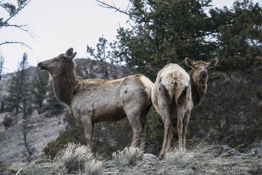
That Old Man of Storr pic is magnificent. As for breakfast – porridge which is tastier than worms! The Vietnamese bridge is stunning too but Danny would Tris lie to us? Anyway loved the orangs and glad to report that after the Chester zoo fire they said yesterday their Sumatran orangs are fine.
LikeLiked by 1 person
PP I passed the Old Man of Storr this year and would have loved to climb up. But the road was choc a block with hundreds of vehicles and there was no chance of squeezing in my motorhome. The hill must be at serious risk of erosion with all those feet.
LikeLiked by 2 people
Dave, I remember when back in my younger days, you could drive up past the Storr and never see another car. Now all over Skye and the Islands, particularly on the North Coast 500, you’d be lucky to find a place to stop and look at any of the scenic places. The power of the internet and what I cal tick-list tourism. Mass tourism, I’m afraid, will ruin – has ruined? – many places world-wide. I’m not adopting a holier-than-thou stance, mind you – we’re all part of the problem but I’ve seen people pull up at, say, Eilean Donan Castle, step out of the car, take a photo and drive straight off again. I’m a pretty keen photographer myself and I often wonder just what sort of shots these folks are getting.
LikeLiked by 2 people
I think you’re right, andi. It’s a tick list thing and a quick pic to prove it.
Venice…tick, Paris…tick. Highlands…tick
And yet, although it is the lifeblood of some places, it will kill them in the end.
LikeLiked by 1 person
Selling costly tickets to see things doesn’t stem the flow of tourists either. For major tourist attractions, it just adds a long line for tickets to the Colosseum and Eiffel Tower for example.
I wonder if Scotland is taking full advantage of potential income from tourists. I have the impression (perhaps wrong) that many roads in the Highlands are winding and narrow, with minimal construction of overlooks at key scenic points providing ample parking and concessions selling food and souvenirs. A licensing agreement for example could insure that there would be a McDonald’s at every scenic overlook. 😉
As for motorhomes and tall rocks, that’s a problem even at tourist destinations that are decidedly less than major. At Scotts Bluff in Nebraska for example…..an historic site on the old Oregon/California wagon train trail to the West……..the drive to the top of the bluff is a narrow two-lane road with tight blind turns. However that does not dissuade people who are driving motor vehicles larger than a three bedroom house.
LikeLiked by 1 person
It’s a nightmare here sometimes, Danny.
Many of the roads are in fact single track with passing places.
https://encrypted-tbn0.gstatic.com/images?q=tbn:ANd9GcQH51jxyWV46mVMVw12RJEXGaoy5dGlxvL3o6pzkUKqCVexG-W1sA
People park in them; have picnics, take selfies… and invariably they are in massive tanks.
Or worse, they stop there, blocking the road while they finish a text message…
GRRRRRRR
LikeLiked by 1 person
Tris…….Those are amazing pictures.
They remind me of a recent video I found of a flyover of the 92 mile road through Denali National Park in Alaska. It’s the only road through the wilderness of a national park that’s the size of New Hampshire. It gives OCCASIONAL and RARE views of Denali (old name……Mount McKinley.) Denali is the highest peak in North America (20, 146 ft,) and it’s more or less inaccessible…..about 120 miles south of Fairbanks and about 240 miles north of Anchorage. You can drive your own car the first 15 miles of the park road, but must then take a Park Service shuttle for the remaining unpaved portion of the 92 miles. Only about 30% of visitors to the park ever catch a glimpse of the mountain which is shrouded in clouds the majority of the time. But the flyover video was made on a clear day, and you spot the mountain briefly.
The view from Clear Lake (mile 85 on the park road) is amazing on the rare day when it is visible.
http://www.alaska.org/videos/denali-park-road-flyover
If you win a lottery, there are a few days in September when you can drive the entire road in your own car. Several YouTube videos are posted from people who won the lottery and made the drive.
The road through Polychrome Pass:
https://www.usatoday.com/story/travel/experience/america/national-parks/2016/09/19/denali-national-park-tips-visit/90516692/
LikeLiked by 1 person
PS: A really nice wildlife video with some great views of the mountain on a clear day.
LikeLiked by 1 person
PPS: ERRATA:
As the previous video correctly states, it’s “Wonder Lake.” (NOT “Clear Lake.”)
Do NOT travel all the way into the wilderness of Alaska and then try to see the mountain from the wrong lake.
LikeLiked by 1 person
Fantastic videos, Danny.
The road was terrifying. I think I’d pretty much need to go on a bus with an experienced guide.
The animals were fantastic though. Especially the mum bear playing in the water with her cubs.
Thanks for posting.
LikeLiked by 1 person
Tris…….I notice that the National Park Service in its promotional material for Denali National Park advertises in a big way the wildlife to be spotted along the park road. This seems to be a shrewd public relations move to help deal with potentially disappointed (angry?) tourists from the lower 48 who make the LONG trip across Canada and the LONG trek into the Alaskan wilderness on the average cloudy day and don’t get to see the big mountain.
It would be something like having to explain to the average tourist at Yellowstone that they’re not going to get to see Old Faithful erupt……..AND Wyoming were as far away and deep into wilderness as Alaska. 😉
I would always want to take the bus with the park service driver and guide. I’m a flatlander who doesn’t manage very well a scary drive on narrow two-lane mountain roads. The Denali Park Road only rises to less than 4,000 ft elevation and they warn you about it. On the other hand, the drive through Rocky Mountain National Park in Colorado is a paved highway in the numbered federal highway system, and so I didn’t think twice about driving it. I failed to take notice of the fact that the National Park’s “Trail Ridge Road” is the highest continuously paved highway in the United States and rises above 12,000 ft for a long distance. My impressed hand prints must still be in the steering wheel of that car. 😉
The tiny little car in the distance is negotiating one of the LESS scary curves on Trail Ridge:
https://www.nps.gov/romo/planyourvisit/trail_ridge_road.htm
LikeLiked by 1 person
Wow… how did you manage for oxygen up there, Danny?
LikeLiked by 1 person
PS….The first road into Rocky Mountain National Park was “Fall River Road”….completed about 1920. Some of it was incorporated into Trail Ridge Road in 1932, but some of the old unpaved road is still maintained by the Park Service and is open as a one-lane scenic drive during the summer, before it’s closed by snow. The road surface looks similar to the unpaved park road at Denali.
I enjoyed these videos, but would not want to drive it. I like the plein air artist who brought his easel and oils and is painting a waterfall. 🙂
LikeLiked by 1 person
No. I wouldn’t drive it either. I noticed the snow poles at the side of the road. Imagine driving that in the snow!!! Also there were sections when the fall was pretty steep… not so bad father down where there were trees.
And the laugh when you got to the top and there was a sign that said “slow”… I’d have been crawling all the way up!
LOL
LikeLike
Tris…….As for oxygen deprivation while driving, the first time I felt it was when I drove west from Denver on a major “Interstate” highway route….I-70. I-70 is a high-speed cross-country four-lane limited access highway, and even though I was not acclimated to high altitudes, I was OK in the car. But then I stopped at the observation point at the west portal of Eisenhower Tunnel on Loveland Pass to take some pictures of the first snowfall which had already covered the high mountains by late October.
Although the I-70 tunnel route passes under 12,000 ft Loveland Pass, it’s still at an elevation of 11,000 ft. I took my camera and walked briskly across the moderately sloping parking lot. I was immediately aware that I was breathing very heavily……almost gasping for air. It scared me until I thought about the 11,000 ft elevation and unlike native Coloradans, I was not acclimated to the altitude.
I did not have any trouble in the car while driving Trail Ridge Road in Rocky Mountain National Park, although when I got out at overlooks, I was careful to move slowly and take deep breaths.
A friend of mine got fairly sick from oxygen deprivation at the top of Pikes Peak, which can be driven in a car and is over 14,000 ft. Colorado natives on the other hand seem to have no serious problems breathing in the high mountains.
LOL……I know what you mean about driving SLOWLY in the mountains. And it does certainly get scarier when you’re above the tree line and no longer have trees by the road that might stop a fall. The scariest part of Trail Ridge Road is along the top of a narrow ridge high above the tree line, with steep drop-offs on both sides.
When I’ve complained to Colorado friends about their state not installing rigid metal barricades at the sides of the mountain roads, they tell me it’s because snow plows can’t push snow over them to clear the roads. So they just install snow poles to mark the edge of the highway which will flex and then later pop back up when snow gets pushed against them.
Snow removal is really important in keeping the cross-country routes to California and the far West open in the winter. I-70 crosses Loveland Pass through the Eisenhower tunnel west of Denver, and I-80 crosses the continental divide in Wyoming at lower altitudes. I-80 reaches 8,640 ft at Sherman Summit near Laramie. Although the elevation of I-80 in Wyoming is lower, the heavy snows west of Cheyenne and Laramie are legendary, and winter closures occur with considerable frequency. The section of the highway west of Laramie was built during the Vietnam War, and is sometimes referred to by locals as the “Snow Chi Minh Trail.”
Colorado’s heavy traffic desperately needs another two lanes on I-70, but adding two more lanes to the Eisenhower Tunnel would cost big money.
https://www.codot.gov/images/photos/highways/dsc_2192.jpg/image
LikeLiked by 1 person
Ah yes, Danny. I can see why they use snow poles instead of fencing.
I’ve never suffered altitude sickness, but a friend who had to work in Denver said it was pretty horrible. My brother also suffered a bit hiking in Nepal.
These tunnels are amazing. I see the Eisenhower tunnel is around 1.5 miles long, so at least not too frightening to be underground for that length of time. I wonder about driving under all that mountain… and then I remember that I use the Eurostar which goes under the sea for 20 miles… and I never thought anything of it.
Even looking a this photograph makes me cold
LikeLike
LikeLike
Tris……Yes, you have some seriously long and deep tunnels, under the ocean and under the Alps. My first underwater tunnel experience was a short one. The Lincoln Tunnel under the Hudson River from New Jersey to Manhattan. 🙂
The Eisenhower tunnel certainly facilitated cross-country traffic moving though Colorado, but trucks over a certain height and/or carrying hazardous materials still have to take Colorado State Highway 6 over the top of Loveland Pass at about 12.000 ft. I hope to take that route sometime. Nice view of the mountains no doubt, but good to check the weather reports before deciding NOT to take the tunnel in the winter. You can do it in the summer of course, but the mountains are prettier after the winter snows.
The major highway routes through the mountains are generally kept open in the winter, but temporary closures in snowstorms are inevitable. There will be signs in advance of mountain passes that warn you of a closure and advise alternate routes. Snow gates like the picture of the one on I-80 are common. I think that I-80 now has some gates that span the entire highway.
I-80 has some awesome pile-ups involving big trucks, like the one in the picture. While the Interstate highway system was envisioned to be high speed routes similar to the German Autobahn but on a continental scale, principal routes to and from California like I-70 and I-80 have become essential infrastructure for the long haul trucking industry. So high speed cross-country car travel down the long wide Interstate highways has become a game of trying to avoid big trucks in front and behind and coming at you from the side. 😉
And on I-80, if you can avoid the winter snows in the Cheyenne/Laramie stretch, then after getting across Nevada, you have the high altitudes and big snows in the Sierra Nevada Range on the California/Nevada border to contend with. I-80 takes pretty much the same route through the High Sierras that the transcontinental railroad took in 1869……both traversing the infamous Donner Pass.
Speaking of feeling cold, I think I posted or sent this video link before, but I like the old television news piece that was made soon after I-80 was opened in Wyoming in the 1970’s.
LikeLiked by 1 person
I don;t think you put that up before, Danny.
I was wondering if it is an interstate, does that mean the Federal Government paid for it? Of was it Wyoming taxes?
LikeLike
Tris……..As I understand it, both the old US Numbered highway system from 1925-26 and the Interstate system from the mid 1950’s were financed about the same way. (The states also have their own state systems.) Washington does the planning and largely finances the construction of federal highways on a federal-state matching basis, and the highways are then subsequently owned, maintained, and operated by the states. The matching formula for construction of the Interstate system was generally 90% Federal – 10% State.
So I-80 in Wyoming is owned and operated by the state of Wyoming, and was largely built with federal funds. In Wyoming, I-80 largely replaced old US Route 30, although US30 is still in commission as a numbered highway. I-80 and US30 are one and the same pavement across much of the state, but US30 does diverge in places.
Their route in Wyoming is historic in terms of the pathways that united the continent. They’re generally along the route of the Union Pacific portion of the first transcontinental railroad of 1869, and also along the route of the Lincoln Highway, the first truly transcontinental highway across America…..New York City to San Francisco. (Given a name, not a number, before the US Highway numbering system went into effect in the 1920’s.)
Some interesting old pictures and more than you would EVER want to know about the lore of the Lincoln Highway….LOL:
https://en.wikipedia.org/wiki/Lincoln_Highway
LikeLiked by 1 person
Yes, that all makes sense, Danny. After all, why would a state want to build a highway that just leads to another state and might simply terminate at the border… It makes sense for the federal gov to build interstate roads and agree a maintenance programme with each state.
Thanks for the link.
LikeLike
Tris…..The history of the US highway system is surprisingly interesting. Consider the fact that when cars started appearing at the turn of the 20th century, there was virtually nothing that could be called a motor road for them to drive on, other than city streets. And so the planning and construction that went into linking up local roads and trails….paved or not…….into a grid that would meet up at state lines.
About a week ago, I found a YouTube upload of two hour long TV documentaries about the first car that successfully traversed the country from San Francisco to New York in 1903……in a country with mostly just city streets and local farm roads. Surprisingly engrossing and entertaining actually, using period photographs and personal journal entries.
I’ll send the link. Not suitable for a single viewing or two, but having bits and pieces that might be of interest. Such as getting lost in Wyoming, but finally making his way to Cheyenne. 🙂
LikeLiked by 1 person
Oh heavens. I’d not want to get lost in Wyoming, at least not in the winter…
I look forward to edited highlights mate.
LikeLike
Bertie the resident Blackbird in the grounds of Munguin Towers wouldn’t thank you for porridge. He is, however, partial to sultanas (although not currents, at which he turns up his beak.)
LikeLiked by 1 person
Not partial to currants? Shocking! 🙂
LikeLiked by 2 people
everyone get Andi’s coat. A mac I presume 🙂
LikeLiked by 2 people
LOL PP…
Play him at his own game (but I doubt we’ll win!)
LikeLiked by 1 person
That’s right, PP, a mac – very useful when it rains. You might even call it an ‘andy mac.
LikeLiked by 2 people
PP Told ya!
LikeLike
Ouch! I hope there’s not a charge for that?
LikeLiked by 1 person
Could be, Tris, would you think that was positive or negative of me? I think we’ve done enough of the electrical stuff – done the whole circuit, so to speak. Time to switch to something else?
LikeLiked by 2 people
if you don’t stop this I’m going to blow a fuse…
LikeLiked by 2 people
I read through this whole thing and got to the end before I got the currants/shocking/charge joke. 😦
LikeLiked by 1 person
It’s a bit of a gas, Danny!
LikeLiked by 1 person
Please don’t, PP. I hate the idea of you blacking out. I was only trying to make light of things.
LikeLiked by 2 people
OH no, PP too… Watt ever next?
LikeLiked by 1 person
ARGHHHHHHHHHHHHHHHHHHHHHH
LikeLiked by 1 person
It’s just a phase that Andi is going through.
LikeLike
LOL…
LikeLiked by 1 person
Could be, Danny. Sometimes I think the power is going to my head. Can’t say why, something just sparked off the idea. Probably nobody’s volt but my own.
LikeLiked by 2 people
Andi…..LOL……OK I give up! At least it was only a single phase. (As you see, I have only one obscure electricity pun.)
LikeLiked by 1 person
I’m staying neutral in this power struggle…
LikeLiked by 2 people
🙂
LikeLiked by 1 person
We all give up with andi in the end. Especially when he’s that wired!
LikeLiked by 1 person
Sorry, guys, but I’m pulling the plug on this…Lights out!
LikeLiked by 1 person
Ohm y goodness!
LikeLiked by 1 person
Watt?
LikeLiked by 1 person
That’s a bit of a volt face.
LikeLiked by 1 person
Please tell me that we have exhausted all the electrical jokes now? 🙂
LikeLike
Am p retty sure it’s nothing.
LikeLike